19
Part Two: Section 2
XM Weather
Textual METAR/TAF Code
ThecurrentairportweatherreportsontheTextual
METARpage(andtheairportweatherforecastsonthe
TAFpage,too)usearathercrypticformatoriginally
devisedforteleprinters.Youcanndinformation
aboutthisformatinanFAApublication,Aviation
WeatherFormats:METAR/TAF,whichcanbedown-
loadedfromtheFAAWebsite.
Youmayseethefollowingcodes,whichdiffer
slightlyfromthecodesdescribedintheFAApublica-
tionreferencedabove,atthestartofaMETARonthe
TextualMETARpage:
• SA=METAR—astandardhourlyMETAR
report.
• SP=SPECI—aSpecialReportinserted
betweenregularhourlyMETARstoprovide
late-breakingweathernews.
TAF Page
WhenaGDL69/69Aisinstalled,theTAF(Termi-
nalAerodromeForecast)pageisinsertedintotheWPT
pagegroup,immediatelyaftertheTextualMETAR
page.
Thispageshowsatextmessagegivingaweather
forecast for a particular airport. The format is similar
tothatusedforMETARS,butdescribesaweather
forecast rather than current weather at the particular
airport.
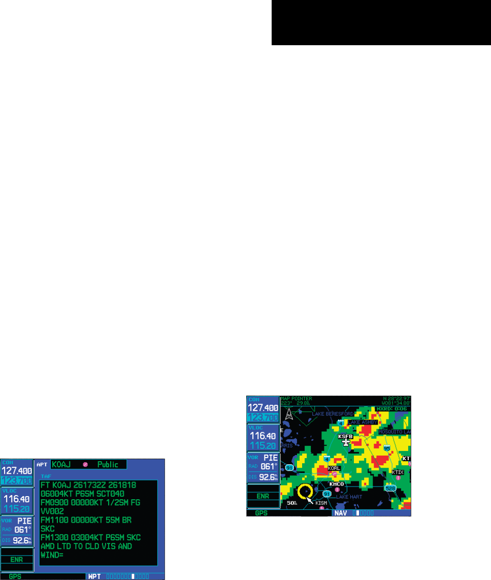
TFR Information
AreaswithTFRs(TemporaryFlightRestrictions)
are shown outlined in yellow on the NAV main page
ofthe500W-seriesandontheMapandXMWeather
pageofboththe400Wand500W-series.More
informationaboutTemporaryFlightRestrictionscan
beseenontheTFRInformationpage,whichcanbe
accessedfromtheMappageortheXMWeatherpage.
1a. With the Map page (the second page of the
NAV page group) displayed, press the small
right knob to bring up the map pointer.
or
1b. With the XM Weather page (the third page
of the NAV page group) displayed, press the
MENU key to bring up the Page Menu. Then,
turn the large right knob to highlight “Show
Map Pointer” and press ENT to bring up the
map pointer.
2. Turn the large and small right knobs to move
the map pointer to the yellow boundary of a
TFR region. When the map pointer is within
the TFR region, its boundary will be highlighted
with a wider yellow line.
190-00356-30 Rev F


